Data Management
This part of the database is only available to registered users. If you have questions concerning the database, please write to Sarah Büssow.
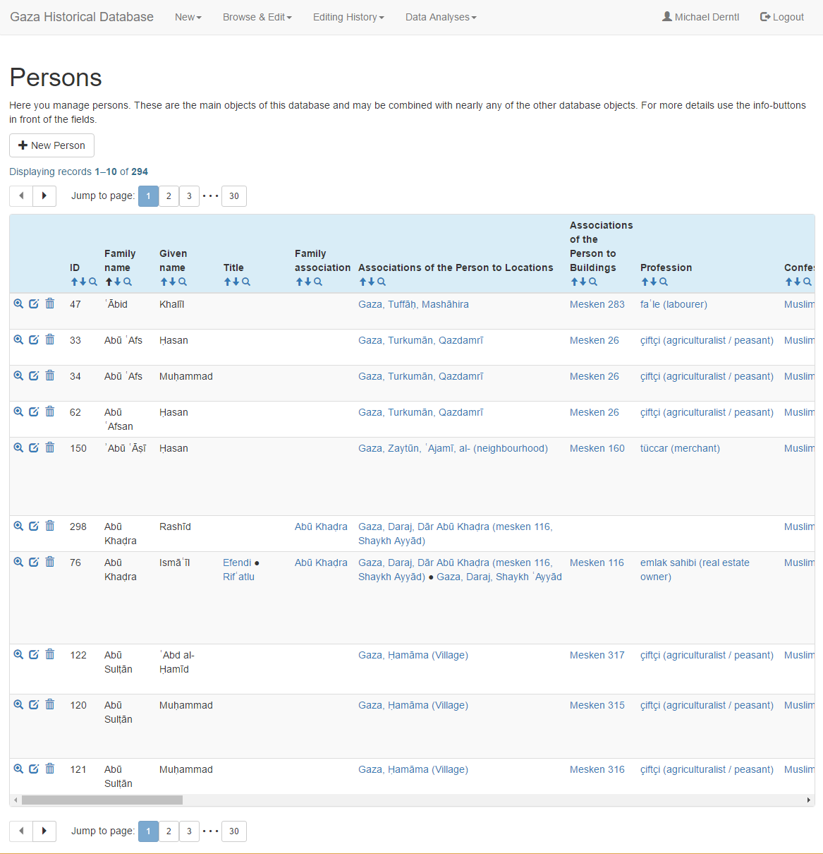
This application is a tool for gathering information about persons, households and families in Gaza and its region during the late Ottoman period.
Our main sources are the Ottoman census of Gaza of 1905 (preserved in the Israel State Archives) and The History of Gaza, an Arabic historical work and biographical dictionary compiled around 1912 by the Gazan scholar ʿUthmān al-Ṭabbāʿ (Itḥāf al-aʿizza fī tārikh Ghazza, ed. ʿAbd al-Laṭīf Zakī Abū Hāshim, 4 vols, Gaza: Maktabat al-Yāzijī, 1999).
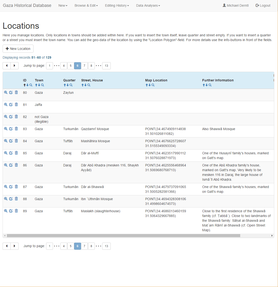
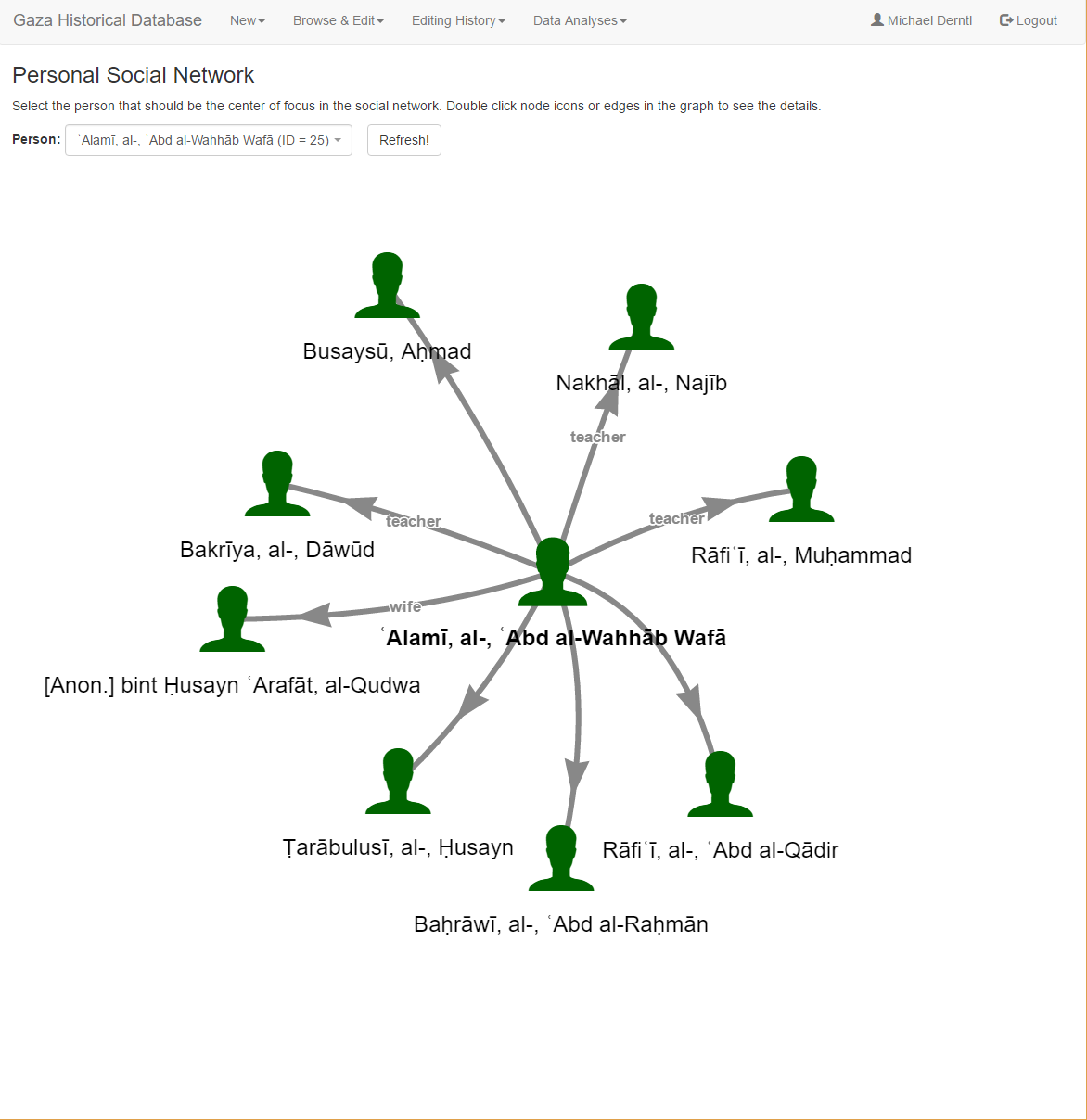
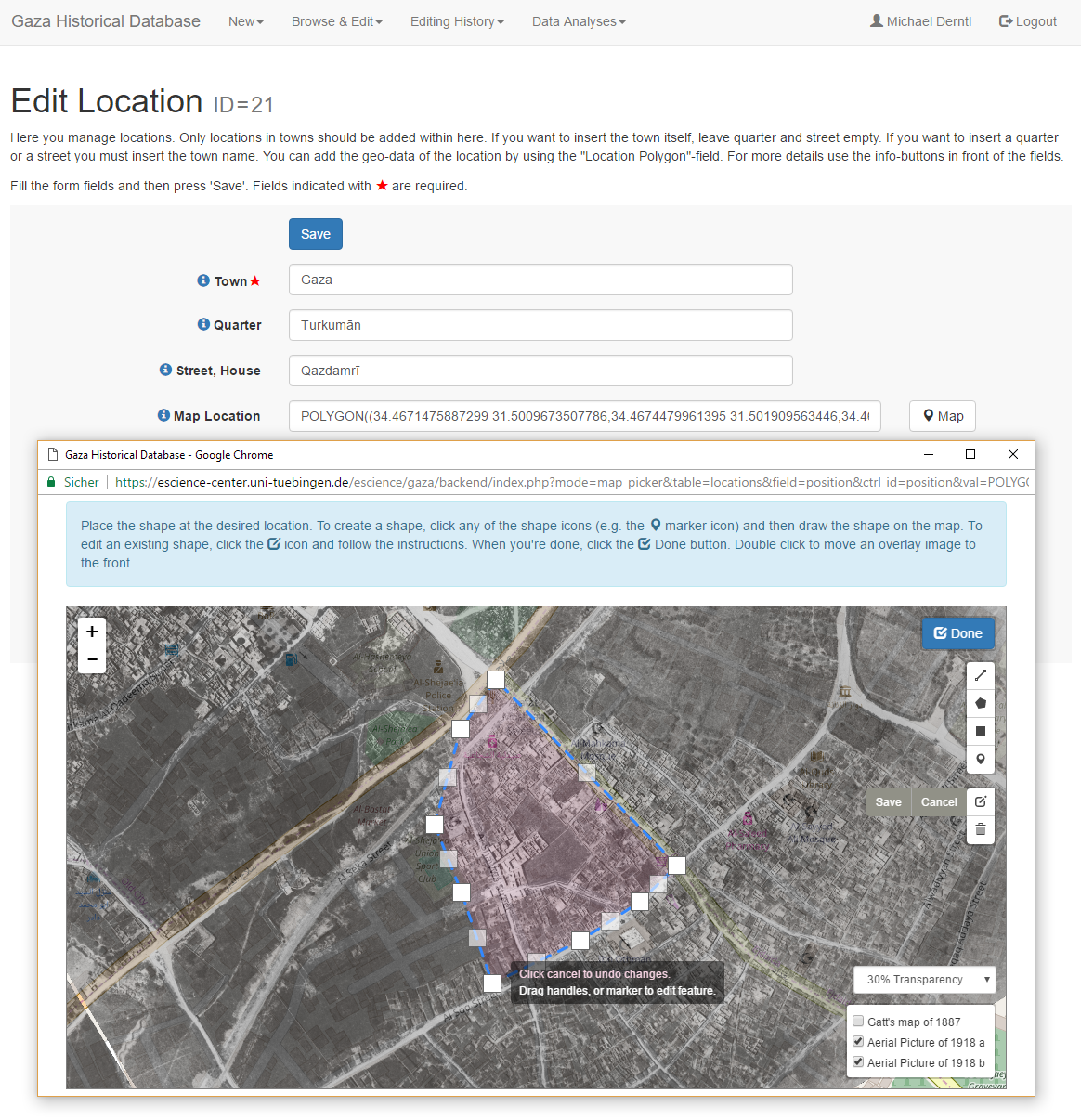
The Interactive Map tool allows us to combine information derived from written sources with geographical data and images in order to reconstruct the social make-up of the city and its parts as well as social networks within and beyond the Gaza region.
We hope that the resulting documentation may also help to raise awareness for the value of Gaza’s many historical buildings, which still bear witness to the region’s Ottoman past.
Technical Description
The Gaza Historical Database is stored in a PostgreSQL database. A web-based user interface allows researchers to insert and collaboratively edit historical data. It also allows to perform data analyses (e.g. the density of occurrence of social characteristics in certain areas of the city) and to generate interactive maps and social network graphs from the database.
The software for the web-based user interface has been developed at the University of Tuebingen’s eScience-Center and is available for download as free open-source software.
Below you may find some screenshots from the data editing interface. Click any of the thumbnails to see a full-screen version.